

Written by: Maren Hale
I recently sat down with Dr. Sasha Gershunov, climate scientist and Heat Hub researcher, for a discussion about the local Southern California climate regime. In our conversation, Dr. Gershunov outlined the unique climate of the region and how it typically changes over a year, he discussed the unusual winter we experienced at the start of 2023, and provided some insight into what climate challenges we might experience this upcoming fall.
The volatility of winter precipitation in Southern California
To begin our conversation, I asked Sasha to provide some insight on the cold and rainy winter we experienced at the start of the year.
“The precipitation regime in Southern California is the most volatile precipitation regime of any place in the United States,” Sasha told me. He explained that, for Southern California, it’s typical to either get very wet or very dry winters. In terms of total annual precipitation, an ‘average’ year is actually extremely unusual. “2016, which was the Godzilla El Niño year and everyone was expecting it to be wet… was actually average. That was the most unusual year of this century so far!” He added that this volatility is expected to increase with climate change “as we lose precipitation frequency, but the intensity of the most intense storms increases.”
What made this winter unique?
So while this past winter was “one of the wettest years in recent history,” as Sasha told me, that wasn’t the main factor that made this year unusual.
Sasha told me “What happened this year was preceded by two extremely dry years” – in fact, it was the third La Niña year in a row. “The previous two were dry, as La Niña years typically are in this region. But La Niña doesn’t guarantee dryness,” and we ended up with an unusual wet La Niña winter. Additionally, the number of atmospheric rivers that made landfall in Southern California this year was also unusually high, and the temperature this winter was unusually cold. “What was really unusual about this year was how cold the storms were,” Sasha told me, which brought “unprecedented snowpack” to California’s mountain ranges, even near the coast.
All about May Gray and June Gloom
Though winter is long gone, the climate in coastal Southern California these past couple months has still been cold and cloudy. I asked Sasha to explain what drives this typical “May Gray” and “June Gloom”.
“May and June is the peak of the season in SoCal for marine layer clouds,” he said. “[These clouds] come about from subtropical subsidence.” This time of year we see a shift in the position of the subtropical zone, which causes air to sink in the atmosphere in our region. The air “gets compressed as it goes down, and the temperature increases.” At the same time that we have “warm, dry air aloft… we have cool moist air from the ocean below it. That’s a type of situation that’s called a temperature inversion,” and it’s conducive to low cloud formation right under that inversion layer. “As the season progresses, the height of the inversion typically lowers, the clouds don’t extend inland as much, and they start burning off in the afternoon. That’s what we’ve been experiencing lately,” Sasha told me.
So this gloomy early summer is quite typical for the region. But how can it vary? Sasha explained:
“Of course, it varies from year to year, and month to month. You can start having clouds in April, which is what happened this year. The clouds can also persist through July, August, and even September, which is what happened back in 2010,” the cloudiest year we know of since the records, put together by Hub researcher Dr. Rachel Clemesha, began in the late 1990s [Rachel published a new paper on low clouds earlier this month]. If the ocean is particularly cold, as it was in 2010, it can create a positive feedback loop with cloud formation as cooler temperatures favor low cloud formation, and low clouds prevent the ocean from warming up by absorbing solar radiation.
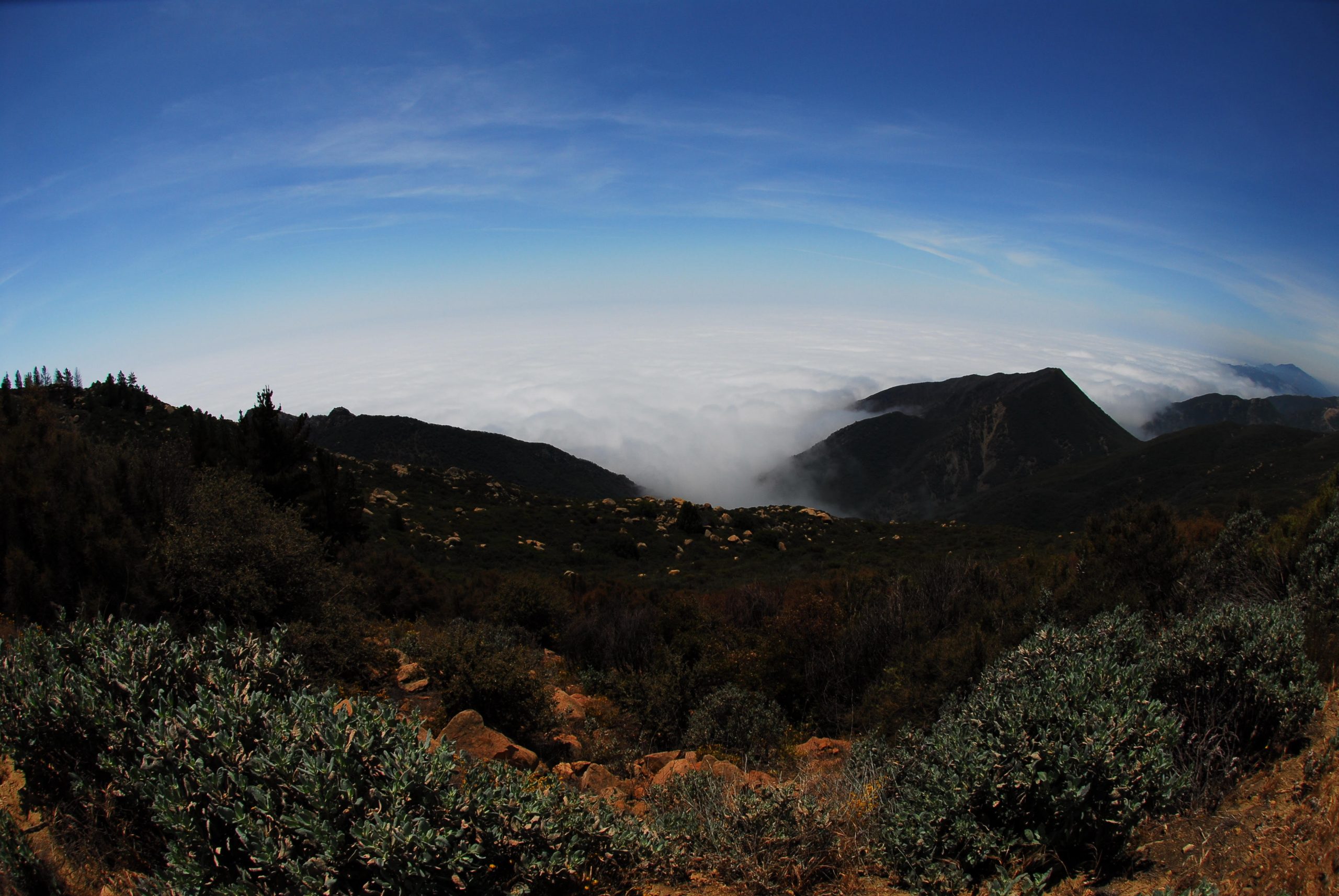
Marine layer clouds as seen from above on the Santa Ynez Mountains. Photo by Sasha Gershunov.
When the extreme heat finally comes
One benefit of marine layer clouds is that they can help minimize heat wave impacts along the coast by providing what Sasha likes to call “natural air conditioning.” “The ocean [partly through its influence on marine layer clouds] really modulates our climate throughout the year,” Sasha described. The presence or absence of marine layer clouds “determines the expression of heat waves in the coastal zone,” keeping temperatures near the coast comfortably cool when they may otherwise be reaching heat wave intensities further inland. He added “When marine layer is absent during a heat wave, however, coastal temperatures soar and emergency rooms can get crowded.”
Our May Gray and June Gloom can help delay the onset of high temperatures in Southern California (much to the chagrin of beachgoing tourists), but extreme heat does come eventually, and Sasha explained that it’s only getting worse: “Heat wave activity has been increasing everywhere around the globe, but in California, and specifically Southern California, [heatwaves are] becoming not only more frequent, more intense, and longer lasting… heat waves are also becoming more humid, which is a double whammy for heat-health impacts” as it makes cooling down by sweating more difficult, “and it doesn’t cool off at night nearly as much.”
Fall heat, Santa Ana winds, and wildfires
Warmer temperatures aren’t just a threat on their own though – the heat can help contribute to hazardous wildfires come fall and winter. Sasha explained:
“Warmer temperatures result in drier vegetation,” as plants increase their evapotranspiration, “which means dryer fuels for the fire season.” Our fire season is different from that in other parts of the state and around the world. “In most places, wildfires are fuel dominated,” for instance, in the forests of Northern California, and “these regions also have more lightning to spark fires,” which typically occur in the summer. Here in Southern California, we don’t have as much heavy fuel (think forests) to ignite, and our ignition sources also differ. “What we have is not a fuel dominated, but a wind dominated wildfire regime,” Sasha told me. As lighter fuels, like grass and scrub, dry out over the summer, “by the time the first Santa Ana winds that mark our fall and winter start up,” any random spark could trigger a wildfire, which could easily spread out of control.
“Our biggest wildfires occur under Santa Ana winds, which start up in the early fall and become more frequent into the winter.” The impacts of these Santa Ana wind-driven wildfires are immense, and not just for those living in the wildland-urban interface where they tend to burn. “Even though impacts are devastating for the people who live nearby, the impacts of the smoke may be even greater” due to the winds that blow this smoke and harmful particulate matter towards the densely populated coast, Sasha described. He also added, “The impacts of Santa Ana winds are not just smoke, but they’re also heat, which can send people to the hospital even in the wintertime,” a focus of work conducted in Hub researcher Dr. Tarik Benmarhnia’s group.
The evolution of the Southern California wildfire season
This description of wildfires being driven by both wind and fuel availability (which is impacted by rainfall and heat) made me wonder… How will climate change potentially affect the wildfire season in Southern California? And what could the wildfire season look like this fall?
“It seems like our fire season is expanding further into winter as we lose winter storms or as winter precipitation gets pushed later” due to climate change, Sasha told me. Though Santa Ana winds begin in the fall, they really hit their peak in winter, and if winter storms are delayed, the vegetation is still very dry. When fires begin under these circumstances, “Then you get huge wildfires that are spread by consecutive Santa Ana winds, which is what happened in December of 2017 when we had the Thomas Fire… It became the largest fire in California at the time” – and is still the largest in Southern California’s history.
“Right now we actually have an overgrowth of light fuels (grasses, etc.) after this very wet winter, which are already dry and ready to burn.” This heightens fire risk even in summer. Sasha’s predicts that “We are probably expecting an anomalously active wildfire season, or at least early season,” however, he qualified, “We can’t really predict Santa Ana wind activity or when precipitation will start next fall, but I think this year’s wildfire season can be expected to at least have the potential to be really extreme.”
What else might winter bring?
Further adding to the complexity of this year’s climate is the fact that we are currently undergoing a shift from La Niña to El Niño conditions, which means predictions are for a wet winter in Southern California. But this isn’t a guarantee: “ Typically… wet weather patterns are more likely than dry ones” during an El Niño, Sasha mentioned, “but it doesn’t guarantee anything. ENSO, though it is the main source of climate predictions here, it’s not a very dependable source.”
The uniqueness of Southern California: closing thoughts
After illustrating an entire year of Southern California climate patterns, Sasha and I contemplated on what makes this region such a unique and fascinating place to study the climate. Sasha reflected, “When I moved to Southern California when I was 12 from a high latitude continental climate, where the seasons were much more obvious, this Southern California climate seemed really bland to me. It seemed like all seasons were the same. I was not sensitive to the more subtle weather and seasonality of this region. But in many ways, this region is extremely volatile. It has extreme variability, especially in precipitation. It has an amazing range of decadal, interannual, seasonal, and day to day variability that is just fascinating, which also is modulated locally and regionally depending on how far you are from the coast. It is also surprising and counterintuitive with summers starting cool under marine layer clouds and fall starting hot under Santa Ana winds. It’s really fascinating to live in and study the climate and weather patterns of this region.”
For more information on Dr. Sasha Gershunov’s research, please visit the WECLIMA website, and follow along on the SoCal Heat Hub website for the latest updates on research from Sasha and all the scientists on our team.
Header image: May Gray envelops La Jolla Shores. Photo by Sasha Gershunov.