I’ve chased a few SOTA activators before, it’s quite a fun thing to do, you watch the spotting website and then see if you can get them. Once someone posts a spot it’s pretty quick for them to get a pile up. I’ve kept thinking about doing it, and I do live in an ideal place where there are plenty of summits to chose from. I’ve not been on the radio much this year and I ended up taking a day off today to drop off and pick up the kids from school, so I decided I should make the most of it and go up a mountain!
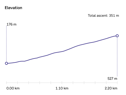
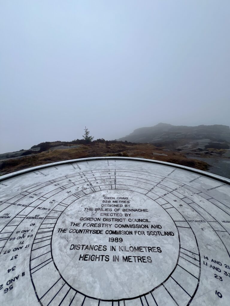
Using the great SOTA map website, Sotlas, I had a look around to see where I should go first. As I was doing the school run, I was limited on time to about 6 hours all in. I also thought I shouldn’t try too much on my first attempt, in both walking and radio setup. I noticed that some summits get bonus points during the winter (between about December and March), and one of those was near me so I thought that would be ideal. The place is called Bennachie, and one of its highest peaks is Oxen Craig. The peaks are call a ‘tap’. This is the summit GM/ES-061, which is worth two points and five in the winter.
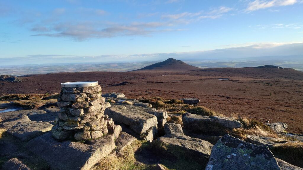
As you can see from this photo taken by MM7MWL, it’s a beautiful view.
Gear
Radio-wise, I still have my Xiegu G90, which was my first radio, that is portable enough – certainly when compared to the Yaesu FTDX10! It’s got a bit of heft to it (2.5 kg 😰), but is 20W, has a great ATU and a nice waterfall.
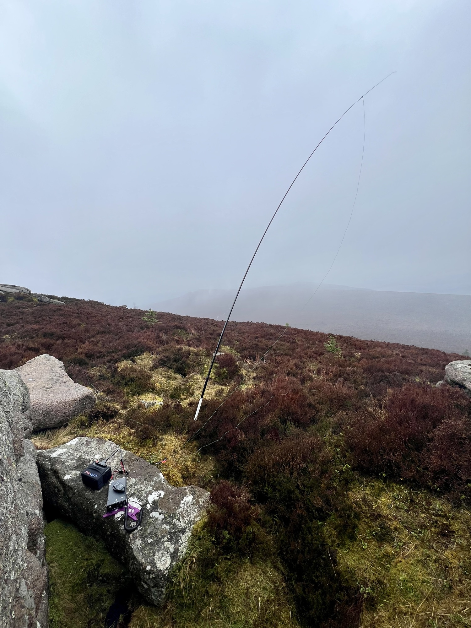
For the antenna, I wanted to keep it as simple as possible and to make use of my carbon 6m mast. I found MM0EFI’s random wire suggestion and it looked ideal. This is 5.5m radiator, with two 4.25m counterpoises. They’re attached via bananaplugs to a BNC, then a short piece of coax with a common mode choke into the radio.
The battery situation isn’t ideal. I’m using an ultramax 18 Ah LiFePO4 battery, which has loads of capacity and much better than a lead acid or a LiPo one but it’s still around 2.5 kg. I use it when out in the garden, but have never had to carry it very far. I do have a few 18650 lithium cells which I’m meaning to make my own portable battery but I’ve not got round to it yet. So the ultramax had to do.
I also brought my Boafeng 2m/70cm radio to try some 2m FM. I have a Kenwood TH-D72, which I thought of bringing for APRS, but it’s too complex for my liking. Plus I could’ve just used my phone for APRS if I really wanted to.
All in, with lunch and water, my backpack was over 6 kg. Fine, but plenty of room for optimisation next time.
The Activation
With the kids dropped off at school, and backpack packed, I set off about 0915 to drive to the car park behind the summit.
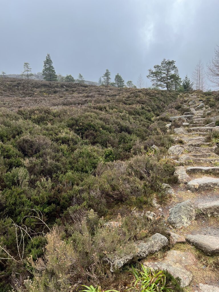
I wasn’t sure how long everything was going to take, so I opted to find the shortest and most direct route to the summit. There are quite a few walks you can do in the area via various taps and approach from different sides, but starting at the “back” looked the quickest. It was basically a straight up.
I had looked at doing two activations in one trip, as Millstone Hill, GM/ES-077, isn’t that far away. However, when I worked out a couple of routes they were 4-5 hours of walking and I decided that was trying to do too much in one day.
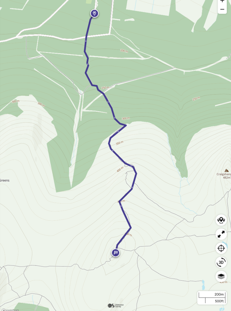
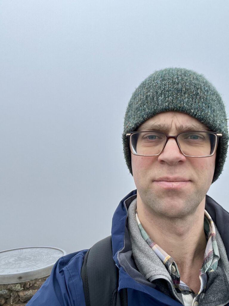
I paid my parking at 0953, and was being blown away on the summit by 1040, which was a bit quicker than the 1:08 hrs OSMaps suggested it would take to walk up. I was pretty hot and sweaty by the time I got to the top, and had taken off my hat, but once exposed in the wind, I was glad to have it.
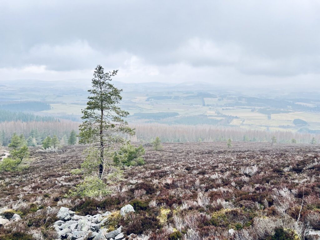
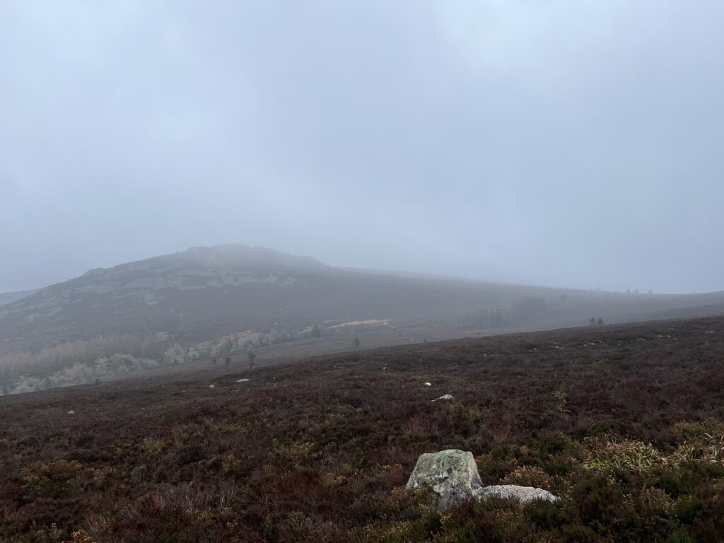
It was quite nice weather on the way up, I could see the summits were under cloud cover, and when I reached the top the wind was howling and the air was very cold.
I looked around for a nice place to setup, and ate my sandwich. Another guy came up and we said hello. I tried a few calls on 145.500 MHz, but I think I would’ve needed to organise this ahead of time with the locals. I found a nice outcrop to shelter behind that was in front of the summit, and setup the pole and radio on a rock. I had a little nook to crouch in and there I started to see if I could make any contacts.

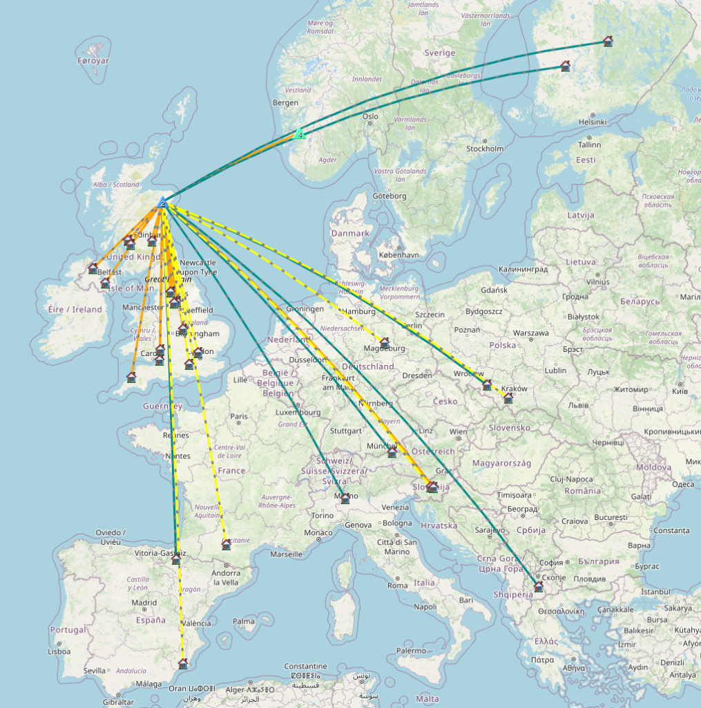
I started on 40m, had a listen to 10m, but it seemed dead, then moved to 15m and then finally 20m. I managed 37 contacts, with 14 countries, two summit to summit QSOs, and one parks on the air contact. My furthest contact was with Z36T in The Republic of North Macedonia at 1501 miles.
I’d been on the air 50 minutes and my logging hand was getting cold! Plus I was getting stiff in my funny crouching position, and concious of getting back in time to pick up the kids. I was using Cloudlogoffline app to log, which is handy as it can then sync to my cloudlog database but I don’t like that it doesn’t keep the frequency from the previous QSO as the default entry. [update: you can under the settings, so set it there before starting to add QSOs.] It’s also fiddly to add another SOTA reference due to the iOS keyboard coming up when you select an input box and not being able to scroll. I might just do ‘Fast Log Entry’ (FLE) next time in an Apple note file. I’ll see what else there is too. VK port-a-log seems to be a favourite for SOTA but it’s Android only.
I was back in time for a nice cup of tea and sit down before it was school pick up. I look forward to the next one. It’s fun being the DX! 📻⛰️
Leave a Reply